
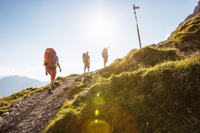
From Schröcken via Fürggele to the Biberacherhütte to Landsteg
To the right of the Hotel Mohnenfluh past the road along the gorge of the Bregenzerache to the Alpe Felle. After 300 m the narrow path on the right side climb up the serpentines. Continue to the rear Fellealpe and to the right getting steeper and steeper to the waterfalls. There again on the right over 3 crests up to the last steep climb to the highest point, the Fürggele (2.145 m). Continue slightly downhill and uphill past the Hochberg and Rothorn towards Litahütte. From here you can see the Biberacher Hütte (1.846 m), which invites you to take a relaxing break. After a short stop, the long road descends to the Landsteg (1.110 m). From the Landsteg you can take the bus back to Schröcken.
Show more
Details.
directions_run Typ:Hiking trail
Level:Hard
arrow_right_alt Distance:14,6 km
access_time Duration:297 min
trending_up Elevation gain:920 hm
trending_down Elevation decrease:1104 hm
GPX DownloadFrom Schröcken via Fürggele to the Biberacherhütte to Landsteg
GPS 47.25390000 / 10.08835000
Profile.
Recommended equipment.
This should never be missing on the mountain.
Backpack, First-Aid Set incl. Bladder plaster, telephone with emergency number, cash, drinking bottle, pocket knife, provisions, sun protection in good weather.
Show more
Directions.
Touring.
Hotel Mohnenfluh - Alpe Felle - Fellealpe - Fürggele - Litahütte - Biberacher Hütte - Landsteg
Show more
Parking.
All information about parking spaces can be found here.
Show more
Public transport.
All information about the buses can be found here.
Show more
Safety.
Emergency numbers.
140 - Alpine emergencies throughout Austria
144 - Alpine emergencies in Vorarlberg
112 - Euro emergency call
Show more